


Land
Your lot lines are not your building site, and the gap is wider than you think
Setbacks are the number people check. Easements are the number that kills the plan. Together they routinely take a two hundred foot wide parcel and hand you sixty five usable feet.
American Barndos — August 21, 2026 — 12 min read
Start here
Almost everyone buying rural land does this in the same order. They walk the parcel, they pick the spot with the view, they fall in love with a plan that is sixty feet wide with a covered porch, and then somewhere between contract and permit they discover that the strip of ground they can legally build on is narrower than the building.
The order that works is the reverse. Draw the envelope first. Pick the plan second.
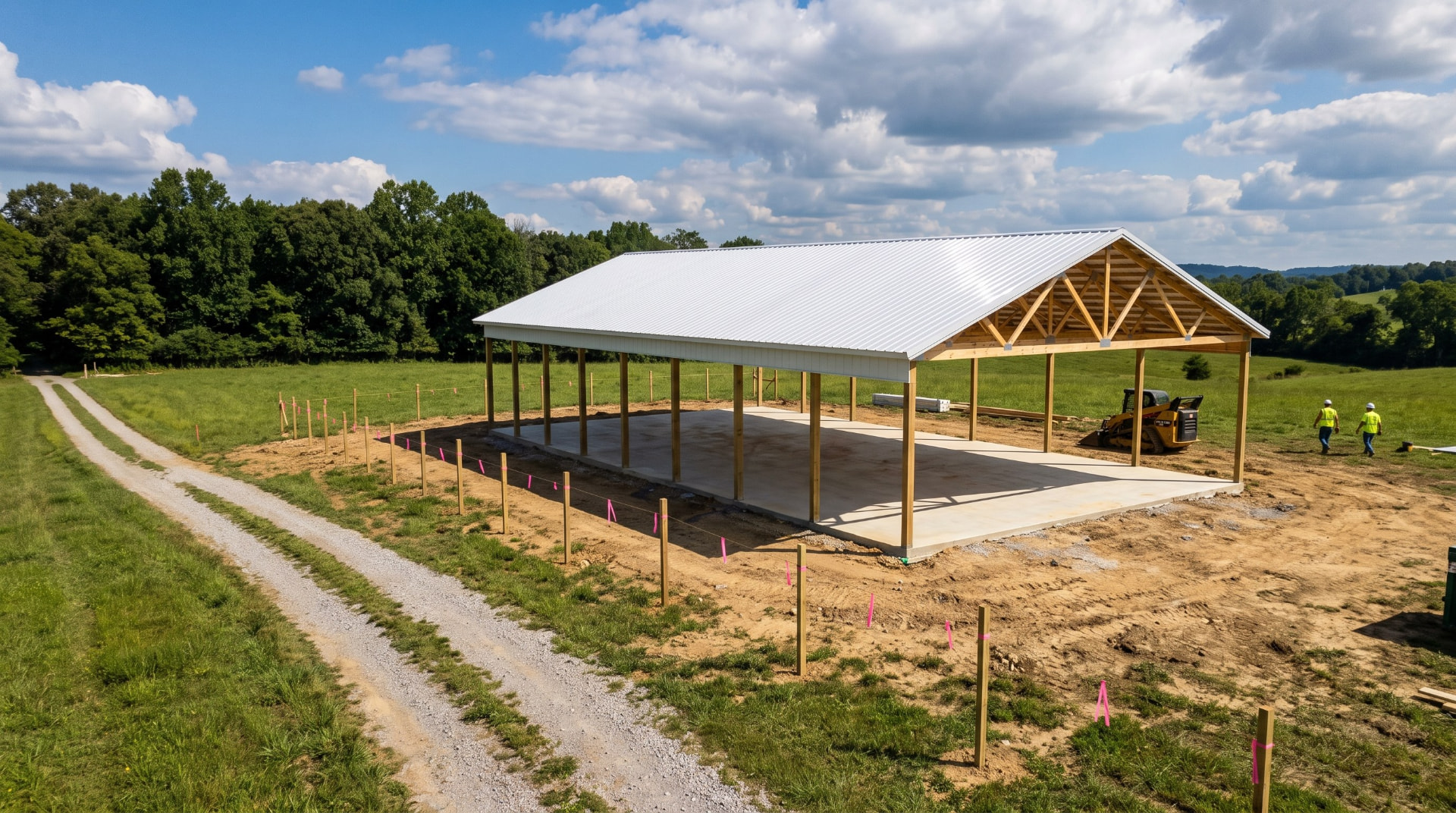
The reason this trips up barndominium buyers specifically is width. A conventional two story house is often thirty to forty feet wide and can absorb a tight side setback without anyone noticing. A post frame or steel barndominium is wide by design. That is the entire point of clear span construction. A forty by sixty building placed with the sixty foot dimension across the lot, plus a two foot eave overhang on each side, plus a ten foot porch on the front, is a footprint that consumes side yard the way nothing else in residential construction does.
This article covers where the lines come from, how to find them on your specific parcel, what they cost to verify, the building code rule that shrinks your envelope a second time after zoning is already done with it, and what happens when the envelope does not fit.
The four lines that shrink your lot
Zoning sets minimum distances between your structure and your property lines. They are called setbacks, and there are normally three of them, sometimes four.
Front setback. Measured from the front line toward the house. Typical range in single family residential districts is 20 to 35 feet.
Side setbacks. One on each side. Typical range is 5 to 15 feet.
Rear setback. Typical range is 15 to 25 feet.
Those ranges are national typicals and they are not your numbers. Your numbers come from the dimensional standards table for your specific zoning district, and rural agricultural districts frequently run larger than the residential ranges above, not smaller.
Three details inside the measurement rule cause most of the surprises.
The setback is measured to the nearest point of the structure, not to the center of the wall. A ten foot side setback means the closest building edge sits ten feet off the line.
The line you measure from is not always the property line. Some jurisdictions measure the front setback from the property line. Others measure from the right of way line, and some measure from the street centerline. Measuring from a centerline can quietly add several feet to your front setback, because the public right of way is usually wider than the pavement. Verify the reference point in the ordinance text before you scale anything on a drawing.
Corner lots usually get two front setbacks. Because both street facing sides are treated as front yards, a corner parcel loses substantially more buildable width than an interior parcel of identical size. Some codes allow a reduced setback on the secondary street, but it typically stays larger than a standard side setback.
What counts as the structure
This is the paragraph that changes barndominium footprints.
Minor architectural components are usually allowed to project into the setback. Roof eaves and gutters are the most common allowance, commonly somewhere between 18 inches and 3 feet of projection. Chimneys often get 2 to 3 feet. Bay windows and covered porches may or may not qualify depending on the ordinance. What does not move is the structural footprint, which has to respect the setback on its own.
Post frame buildings have deep overhangs. Twelve to twenty four inches is normal, and wider is common on the eave side where the roof is doing work shedding water away from a slab on grade. If your ordinance allows an 18 inch projection and your plan carries a 24 inch overhang, the roof is out of compliance even though the wall is fine.
The fix is almost always trivial at the drawing stage and expensive after the trusses are set. Check the projection allowance in the same phone call where you check the setback.
Covered porches are the bigger risk. A ten or twelve foot covered porch across a gable end is a structure with posts and a roof, and in most ordinances it is part of the footprint rather than a projection. Treat the porch as building, not as an extra.
Easements: the restrictions a zoning board cannot waive
A setback is a rule your municipality wrote and, in theory, your municipality can vary. An easement is a legal right that belongs to somebody else. A utility, a neighbor, a drainage district, a pipeline operator, a state department of transportation. A zoning board of appeals cannot vary it, because it does not own it.
That distinction is the single most important thing in this article. When people say a variance fixed their setback problem, they are describing a setback problem. Easement problems do not get fixed at a public hearing.
What they are
Utility easements give a provider the right to install and maintain lines and to bring equipment in to do it. Drainage easements protect the path water takes across the parcel. Access easements, also called ingress and egress easements, give somebody the right to cross your land to reach theirs, which on rural parcels is often the neighbor behind you. Pipeline easements carry their own operator rules and are frequently the most restrictive corridor on a rural property. Prescriptive easements arise from long uninterrupted use rather than from a document, which is why they are the ones that do not show up in a records search.
How wide
Published widths vary considerably by source and by utility type, and the variation is the point rather than sloppy sourcing.
| Easement type | Typical width, published ranges |
|---|---|
| Utility easement shown on a subdivision plat | 5 to 10 feet |
| Underground electric | 10 to 20 feet |
| Overhead electric distribution | About 30 feet |
| High voltage transmission | 50 feet and up |
| Water and sewer | 20 to 30 feet and up |
Two sources disagree materially here. Plat based utility easements are commonly reported at 5 to 10 feet, while easements documented from the utility side are reported at 10 to 30 feet or more. Both are reported above rather than averaged, because the width is written in the specific recorded instrument for your parcel and no general figure substitutes for reading it. The width is set to accommodate equipment access and repair staging, not just the buried line, which is why the corridor is usually far wider than the infrastructure inside it.
What you cannot put in one
Permanent structures with foundations are the clearest prohibition. Home additions, detached garages, in ground pools, concrete patios, and retaining walls are out. The holder needs unobstructed access, permanently, and the language in most easement grants is written to protect the holder rather than you.
If a structure has to come out, you pay. You pay the removal, and you pay any additional cost the holder incurs working around what you built. Most easement language also releases the holder from liability for damage to unauthorized improvements. Title companies may decline to insure over a known encroachment, and lenders may decline to fund until it is resolved.
The overlap nobody explains
Here is the arithmetic detail that decides whether an easement costs you anything at all.
Easements and setbacks frequently run along the same edge of a parcel and overlap. If your side setback is 15 feet and a 10 foot utility easement runs inside that same 15 feet, the easement costs you nothing, because you already could not build there. If the easement is 20 feet, it costs you 5 feet, because the binding constraint is whichever line sits farther into the lot.
So the buildable envelope is not setbacks plus easements. It is the greater of the two on each edge, measured edge by edge. People who add them together scare themselves out of good parcels. People who assume they always overlap get surprised on the one edge where the corridor runs wide.
You can normally build right up to the outside edge of an easement, though your ordinance may impose its own buffer beyond it. Ask, because that buffer varies.
If the corridor is in your way
Two paths exist, and neither is fast. An encroachment agreement asks the holder to permit a specific improvement inside the corridor, and it requires a certified site plan or survey, construction drawings, and clearance specifications. There is no standard timeline. Reviews are case by case. A release or relocation asks the holder to give up or move the right, which normally requires their written cooperation. Proving abandonment without cooperation means demonstrating decades of non use plus intent to permanently surrender, which is a litigation grade standard, not a phone call.
Plan the building around the corridor. It is the cheaper move every time.
Where these lines are actually written down
Four documents and one professional. Use them in this order.
- The county GIS or zoning portal. Free, immediate, and good enough to tell you your zoning district and roughly where the lines fall. Not authoritative for anything you are going to build on.
- The recorded plat. Filed with the county recorder or the planning department. It shows lot boundaries, platted building lines, and platted easements. It is the cheapest document that shows an easement.
- The deed and the recorded instruments. Express easements are created in writing and recorded. They name the parties, the permitted use, the dimensions, and the duration. They will not show prescriptive easements or easements by necessity.
- The title commitment, Schedule B, Section II. This is the list of recorded exceptions affecting your parcel, with book and page or instrument numbers so you can pull each original document. If you take one action from this article, make it this one: read Schedule B Section II line by line before your inspection period closes, and pull every instrument it references. It is free, you already paid for it, and almost nobody does it.
- A licensed surveyor. Records tell you what is written. A survey tells you what is on the ground, which is where encroachments, unrecorded claims, and worn access routes actually show up.
What a survey costs in 2026
| Survey type | Typical published cost |
|---|---|
| Plot plan | $100 to $250 |
| Mortgage or location survey | $200 to $700 |
| Boundary survey | $300 to $900 |
| Plat survey | $400 to $800 |
| New construction stakeout | $400 to $1,800 |
| ALTA survey | $1,200 to $4,000 |
Acreage drives price more than most people expect, and it drives it by perimeter rather than by area.
| Parcel size | Typical boundary survey cost |
|---|---|
| Half acre | $300 to $900 |
| 1 acre | $500 to $1,000 |
| 5 acres | $1,000 to $3,000 |
| 10 acres | $1,500 to $4,000 |
| 25 acres | $2,000 to $5,000 |
| 50 acres | $5,000 to $7,000 |
| 100 acres | $7,000 to $9,000 |
For sites between 50 and 100 acres, per acre pricing commonly runs $70 to $140. A separate published range for standard residential surveys runs $500 to $3,500 and up depending on lot size, terrain, and how clean the records are. Wooded, steep, or poorly documented rural parcels sit at the top of every range on this page.
Set against a plan set, a slab, and a shell, a boundary survey is the cheapest insurance on the project. Against the cost of moving a completed noncompliant structure, it is not close.
Doing the arithmetic
Take a rectangular parcel 100 feet wide. Zoning requires a 15 foot side setback on each side.
100 minus 15 minus 15 leaves 70 feet of buildable width.
Now place a 60 foot wide building with a 2 foot eave overhang on each side. The roof measures 64 feet across. It fits, with 3 feet of clearance on each side. Comfortable.
Now add a 20 foot wide utility easement along the west line. The easement extends 5 feet past the setback, so the west edge of the envelope moves in 5 feet.
100 minus 20 minus 15 leaves 65 feet. The 64 foot roof still fits, by one foot, and you have lost every inch of tolerance for a survey correction, a slightly out of square layout, or a change order that widens the overhang.
Now suppose the covered porch on the gable end is 12 feet deep and the rear setback is 25 feet on a shallow parcel. Run the same subtraction on the depth axis before you assume the front to back dimension is the easy one.
Nothing in that sequence is complicated. It is arithmetic. The reason it does not get done is that it requires the plat, the ordinance, and the recorded easement instruments to be sitting on the same desk at the same time, and most buyers assemble those three things after they have already chosen a plan.
The part nobody writes about: the second rule that shrinks the envelope
Zoning is not the last authority to measure the distance between your building and the lot line. The building code measures it too, for a completely different reason, and it produces a completely different set of restrictions.
The residential code uses a term called fire separation distance, measured from the building element to the lot line. Under the model International Residential Code table, the thresholds work roughly like this.
| Building element | Requirement | Minimum fire separation distance |
|---|---|---|
| Exterior wall, fire resistance rated | 1 hour rating, tested from both sides | Less than 5 feet |
| Exterior wall, not rated | 0 hours | 5 feet or more |
| Projection, fire resistance rated | 1 hour on the underside | 2 feet up to 5 feet |
| Projection, not rated | 0 hours | 5 feet or more |
| Openings in walls | Not allowed | Less than 3 feet |
| Openings in walls | 25 percent maximum of wall area | 3 feet |
| Openings in walls | Unlimited | 5 feet or more |
Read that table with a post frame building in mind and two things jump out.
Your overhang is measured, not your wall. A wall placed 5 feet off the line is clean. Put a 2 foot eave on it and the projection sits 3 feet off the line, which lands it inside the rated band. The most common barndominium detail in the country, a generous eave over a slab on grade, is the element that trips this rule.
Openings are the constraint that hurts. At 3 feet of fire separation distance, windows and doors are capped at 25 percent of that wall's area. Below 3 feet they are not permitted at all. On a barndominium the long elevation is usually the view elevation, and it is usually the one carrying the glass. A tight side setback does not just move the building. It can take the windows off the side you bought the land for.
Two important caveats. First, these are model code values, and states amend them. Minnesota's adopted version, for example, does not allow walls at all under 2 feet or projections under 3 feet, which is stricter than the model table on projections. Your adopted code and your local amendments govern. Second, dwellings sprinklered throughout are evaluated on a separate, more permissive table.
Ask your building department which code edition they have adopted, and whether they have local amendments to R302.1, in the same call where you ask about setbacks. It is one question and it can change which elevation your windows live on.
Everything else competing for the same ground
The envelope is not only competing with the building. Inside whatever is left, you still have to fit a driveway that cannot cross a drain field, a septic field and its required reserve area, a well with the largest setbacks on the property, and a staging area where a crane or a telehandler and a truss delivery can physically park during the shell. Septic siting is covered in its own article, and it is worth reading before you commit to a plan, because on a constrained parcel the field and the envelope get decided together or they get decided twice.
If the parcel touches water, add environmental buffers on top of everything above. Federal guidance recommends at least 35 feet of undisturbed riparian buffer, increasing to 50 feet or more where water quality is a concern, and coastal parcels carry their own additional requirements.
And if the parcel is in an HOA or carries deed restrictions, those can impose setbacks stricter than the county's. The stricter rule wins, a building permit does not immunize you from a private covenant, and HOA enforcement can demand removal independently of anything the county said.
When the envelope does not fit: the variance
A variance asks the zoning board of appeals to relax a dimensional requirement for your specific parcel. It applies to setbacks, height, and lot coverage. It does not apply to easements.
The standard is deliberately hard to meet. You have to show the hardship comes from the land itself, not from you.
What counts: unusual topography, an oddly shaped lot, wetlands that reduce the buildable area, an unusually narrow lot width.
What does not count: a growing family, cost, or preferring the building where you pictured it.
The trap: the self created hardship doctrine. Boards deny variances when the applicant caused the problem, and that expressly includes buying the property already knowing about the restriction, and building first and asking later. Choosing a sixty foot wide plan for a lot that cannot hold sixty feet is, in the eyes of most boards, a hardship you created at checkout.
What it costs and how long it takes
| Item | Typical published range |
|---|---|
| Filing fee, non refundable | $250 to $2,000 and up |
| Required site plan or survey | $300 to $5,000 |
| Recording fee after approval | $25 to $90 |
| Public notice period | 2 to 4 weeks |
| Board decision after the hearing | 30 to 60 days |
| Variance validity before it expires | Typically 1 to 2 years |
| Window to appeal a denial in court | Commonly 30 days |
Neighbors within roughly 200 to 500 feet get mailed notice, and a sign goes up on the property stating what you have asked for. Your neighbors will know, and they get to speak at the hearing. On rural parcels that is not a small consideration.
If you are denied, appealing to court means arguing the board acted arbitrarily or without evidence, which is a high bar. Reapplying after addressing the board's stated concerns succeeds more often than appealing does.
And building without the variance produces stop work orders, daily fines, injunctions, potential demolition, a clouded title, and a sale that falls apart years later when a buyer's surveyor finds it.
What to ask your planning and zoning office
Call before you make an offer. Ask these, and write the answers down.
- What zoning district is this parcel, and what are the front, side, and rear setbacks for it?
- What line do you measure the front setback from: the property line, the right of way line, or the street centerline?
- Is this treated as a corner lot or a double frontage lot, and does that create a second front setback?
- What projection is allowed into the setback for eaves and gutters, and does a covered porch count as a projection or as footprint?
- Are there platted building lines on the recorded plat that are stricter than the zoning setbacks?
- Which building code edition have you adopted, and do you have local amendments to the fire separation distance requirements in R302.1?
- Are there overlay districts on this parcel, such as a watershed, wellhead protection, shoreland, floodplain, or scenic corridor, that impose stricter standards than the base district?
- What is your current turnaround from variance application to a decision, and when does the board meet?
Question five is the one that catches people. A platted building line recorded by the original subdivider is a private restriction that can sit farther inside the lot than the county's zoning setback, and it does not appear in the zoning ordinance at all.
Before you buy the land
- Pull the recorded plat and read the platted easements and building lines.
- Read Schedule B Section II of the title commitment line by line and pull every instrument it references.
- Ask the seller directly about any access route, shared driveway, or utility crossing that is in use but not recorded.
- Get the zoning district and its dimensional standards in writing from the planning office, not from a listing.
- Do the width subtraction and the depth subtraction on paper before you shortlist a plan.
- Budget a boundary survey as a real line item, and make it a contingency if the parcel has any ambiguity in its records.
- Confirm the projection allowance against the actual overhang on the plan you want.
- Confirm the adopted code edition and any amendments affecting walls and openings near the lot line.
- Assume a variance will not be granted, and buy a parcel that works without one.
A note on scope
This article is general education for people evaluating rural land for a barndominium. Zoning, setback measurement, easement law, and building code adoption are state and county specific, and in many places parcel specific. Nothing here is a substitute for your planning and zoning office, your building department, a licensed surveyor, or a real estate attorney reviewing your title commitment. Cost figures are typical published ranges as of 2026 and vary substantially by market and by site. Code values cited are from the model residential code and are superseded by your locally adopted edition and amendments.
American Barndos sells architectural design documents. We do not perform surveys, prepare site plans, obtain permits or variances, or provide legal advice, and a plan set is not a site plan.
Ready to look at plans?
Once you have subtracted the setbacks and the easements, you know the maximum width and depth your parcel will hold. That is the number to shop with. Browse plans by footprint, clear span, and shop configuration to find one that fits the envelope you actually have, and download a free watermarked preview to check the dimensions against your own arithmetic.
Related reading
- Is a barndominium allowed on this land? Zoning, covenants, and agricultural exemptions.
- Your perc test decides where the house goes, not just the septic.
- What it costs to run power and water to rural land.
Sources
Cost figures, dimensional ranges, easement widths, code values, and process timelines above are drawn from the following published references, accessed September 2026. All figures are national typical ranges and are superseded by your local ordinance, your adopted building code, and the recorded instruments affecting your parcel.
- HomeGuide, "How Much Does a Land Survey Cost? (2026)": survey cost by type, boundary survey cost by acreage, per acre pricing for large parcels. https://homeguide.com/costs/land-survey-cost
- LegalClarity, "Property Setback Requirements: Rules and Violations": setback definitions and typical ranges, measurement to the nearest point of the structure, right of way and centerline measurement, corner lot double frontage rules, permitted projections, nonconforming structures, enforcement consequences, title and financing effects, riparian buffer guidance. https://legalclarity.org/what-are-the-setbacks-required-on-my-property/
- LegalClarity, "Zoning Variance: Standards, Hardship, and Approval Process": area versus use variance, the unnecessary hardship standard, the self created hardship doctrine, application materials, notice radius, filing fees, hearing and decision timelines, variance validity, and appeal window. https://legalclarity.org/zoning-variance-standards-hardship-and-approval-process/
- LegalClarity, "How Close Can You Build to a Utility Easement?": easement widths by utility type, prohibited structures, adjacent construction and buffers, holder access and removal rights, cost responsibility, encroachment agreements, and release or abandonment standards. https://legalclarity.org/how-close-can-you-build-to-a-utility-easement/
- BatchData, "Easement Records: 5 Public Sources to Check": recorded deeds and easement instruments, subdivision plats and platted easement widths, assessor parcel records, agency and utility right of way records, title commitment Schedule B Section II, and the limits of records searches against prescriptive easements. https://batchdata.io/blog/public-records-easements-right-of-way
- Minnesota Office of the Revisor of Statutes, Minnesota Rules 1309.0302, and published reproductions of IRC Table R302.1(1): exterior wall fire resistance rating by fire separation distance, projection requirements, opening limitations and prohibitions, sprinklered dwelling table, and the detached accessory structure exemption. https://www.revisor.mn.gov/rules/1309.0302/
Note on easement widths: sources four and five publish materially different figures, roughly 10 to 30 feet and roughly 5 to 10 feet respectively. Both are reported above rather than averaged, because easement width is fixed by the specific recorded instrument for a given parcel and no general figure is meaningful without reading it.
Note on code values: the fire separation distance table above reflects the model International Residential Code. Minnesota's adopted version, cited as an example of state amendment, is stricter on walls and projections. Confirm the edition and amendments your jurisdiction has adopted before relying on any value in that table.
Founding list
Join the founding list.
The catalog opens to the founding list first, at founding pricing, before it goes public.